Strong Winter Storm Targeting The Region
Forecasters are calling Saturday a First Alert Day as a strong winter storm moves into southeast Minnesota and northeast Iowa. Current projections show that many communities could pick up 6 inches or more of snow by the time the system exits the region.
The storm will bring periods of light, moderate, and heavy snow, with the most intense bands expected during the day on Saturday. Roads are likely to become snow covered and slick, especially during the afternoon and evening when snowfall rates increase.
This system will be the first significant snow event of the season for many people, and it will likely have a big impact on travel, weekend plans, and holiday activities.
Winter Storm Warnings And The Highway 14 Line
The National Weather Service has issued Winter Storm Warnings for all counties along and south of Highway 14. These warnings will be in effect from early Saturday morning through early Sunday morning.
Highway 14 is expected to be an important dividing line in this storm. Areas along and south of the highway are most likely to see the heaviest snow totals, while locations north of Highway 14 may see lighter amounts and a sharper cutoff in totals.
If you live north of Highway 14, you may still see accumulating snow, but amounts should drop off quickly the farther north you go. Those south of Interstate 90 are currently favored for the highest totals in the region.
Snow Timing: When The Heaviest Bands Will Arrive
Light to moderate snow is expected to begin moving into the region after 8 to 9 p.m. on Friday. This first round will bring some accumulation overnight, especially on grassy and elevated surfaces.
Early Saturday morning, pockets of dry air may limit steady snowfall for a few hours. Some locations could see breaks or lighter snow during the morning, which may lead people to underestimate the strength of the system.
As the center of low pressure tracks into southern Iowa by late morning and early afternoon, snow will redevelop and spread back across southeast Minnesota and northeast Iowa. This is when forecasters expect moderate to heavy snowfall to set up, with the worst conditions during the afternoon and evening hours on Saturday.
By late Saturday night and early Sunday morning, snow should gradually taper off from west to east, with lighter snow or flurries lingering before the system exits.
Travel Impacts: Worst Conditions Saturday Afternoon And Evening
Travel impacts on Friday are expected to be minor, since snow should hold off for most locations until later in the evening. Roads will likely remain just wet or lightly coated until temperatures drop and the snow begins to stick.
On Saturday morning, some roads may become slick, but the worst conditions are forecast for the afternoon and evening. This is when the heaviest snow bands are projected to move through, creating rapid accumulation, reduced visibility, and snow-covered highways.
Those who plan to travel on Saturday, especially along and south of Highway 14 and near I‑90, should be prepared for:
- Snow-covered and slippery roads
- Periods of low visibility during heavier bursts of snow
- Longer travel times and possible spinouts or slide-offs
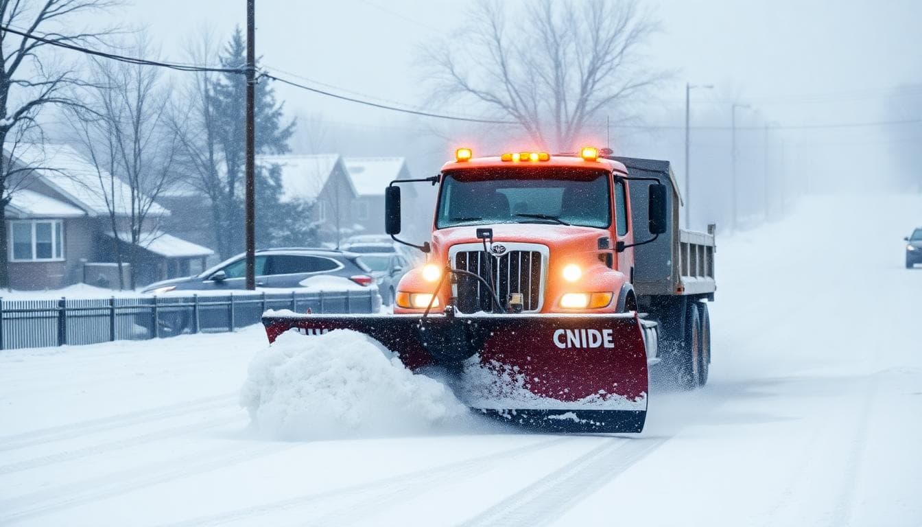
- Plows working throughout the day to keep main routes passable
If you can adjust your plans, avoid longer trips during the peak of the storm and check road conditions before heading out.
Expected Snowfall Totals
Forecasters expect most of the region to pick up around 5 to 10 inches of snow from this system. The highest totals are still expected to fall south of Interstate 90, where the strongest snow bands line up.
Snow totals will likely drop off quickly north of Highway 14. Communities well north of the highway may see lighter snow amounts, while areas closer to and south of the highway could see much higher totals over a short distance.
While the overall forecast has stayed fairly steady, the exact placement of the heaviest bands can still shift slightly as the storm approaches. Small changes in the track can lead to big differences in totals from one town to the next.

Safety Tips For A First Alert Day Winter Storm
With heavy snow and slick roads expected, it is important to take extra precautions. A First Alert Day is meant to give you time to prepare and adjust your schedule before the worst conditions arrive.
Here are some simple safety tips for Saturday:
- Finish errands and travel early, before the heaviest snow moves in.
- Keep extra blankets, warm clothing, and a small winter kit in your vehicle.
- Charge phones and devices in case of scattered power outages.
- Clear sidewalks and driveways in stages, rather than waiting until all the snow has fallen.
- Check on neighbors, especially older adults or anyone who may need help with shoveling or transportation.
Parents should also plan extra time if they need to travel with kids, and remind them about staying clear of snowplows and busy roadways.
Looking Ahead: Cold Pattern Continues
After the storm moves out, colder air will settle over the region. Fresh snow on the ground can help nighttime temperatures drop even more, so icy patches are possible on untreated roads and sidewalks into Sunday and early next week.
Another round of light snow or flurries may be possible in the days ahead, but the main focus for now is the strong Saturday system bringing the widespread heavy snow.
As always, the forecast may be fine-tuned as new data comes in. Local meteorologists and the National Weather Service will continue to update snowfall maps, timing graphics, and travel impact forecasts as the storm approaches.
Key Takeaways For Saturday
- First Alert Day in effect for Saturday due to a strong winter storm.
- 6 inches or more of snow likely in many locations, with 5 to 10 inches across much of the region.
- Heaviest snow expected along and south of Highway 14, with highest totals south of I‑90.
- Worst travel conditions expected Saturday afternoon and evening.
- Roads will be snow covered and slick; allow extra time and consider delaying non-essential travel.
Stay tuned to local forecasts, weather apps, and official alerts for the latest updates as this First Alert Day winter storm moves in.
To contact us click Here .